Best Handheld GPS for Fieldwork, GIS & Outdoor Navigation
Choosing the right handheld GPS can save hours in the field and improve data accuracy. We tested and reviewed the best handheld GPS units for forestry, GIS surveys, hiking, and professional outdoor work.
Quick Comparison – Best Handheld GPS
| Model | Best For | Accuracy | Battery | |
|---|---|---|---|---|
|
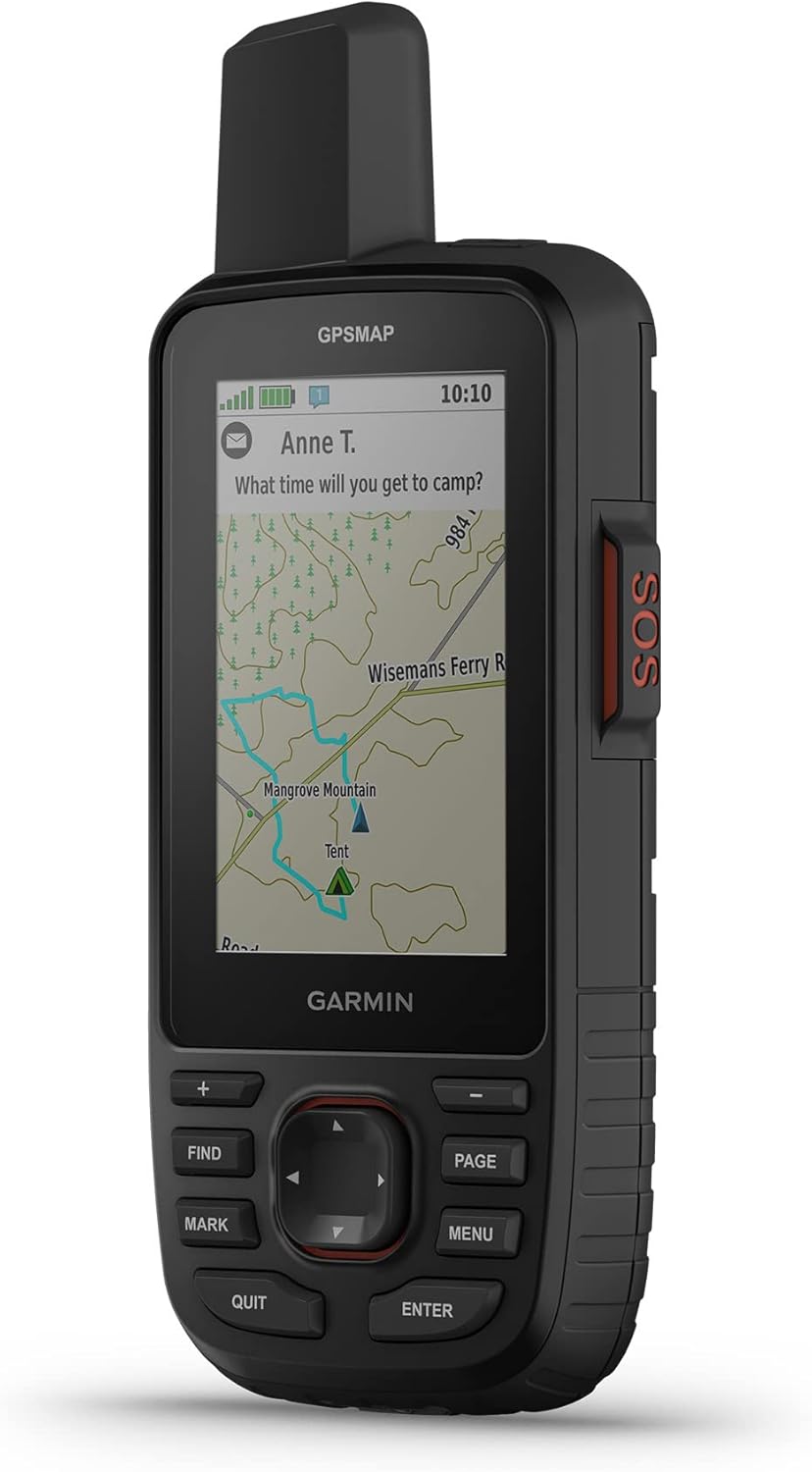
Garmin GPSMAP 67i Best Overall |
GIS / Forestry |  |
180 hrs | Check Price |
|
Garmin eTrex Solar Best Value |
Field Survey | |
Solar | View Deal |
|
Garmin Foretrex 801 Best Rugged |
Hiking / Military | |
48 hrs | See on Amazon |
Best Overall Handheld GPS
Garmin GPSMAP 67i
The Garmin GPSMAP 67i is one of the most accurate handheld GPS devices available today. It supports multi-band GNSS, excellent battery life, and satellite communication for remote field operations.
- Multi-band GNSS (GPS, GLONASS, Galileo)
- Up to 180 hours Expedition mode
- InReach satellite SOS & messaging
- Excellent for GIS & forestry work

Best Value Handheld GPS
Garmin eTrex Solar
If you want a reliable handheld GPS without frequent charging, the eTrex Solar is a solid choice. Ideal for long survey days and eco-friendly fieldwork.
- Solar-assisted charging
- Lightweight and compact
- Simple interface
How to Choose the Best Handheld GPS
When selecting a handheld GPS for GIS or outdoor navigation, focus on accuracy, battery life, satellite support, and map compatibility.
- Accuracy: Multi-band GNSS performs better under canopy
- Battery: 20+ hours for full-day field surveys
- Maps: Support for GPX, KML, and custom maps
- Durability: IPX7 or MIL-STD rated
Frequently Asked Questions
Is a handheld GPS better than a smartphone?
For professional fieldwork, yes. Handheld GPS units offer better accuracy,
longer battery life, and stronger satellite reception.
Can I use handheld GPS data in GIS software?
Yes. Most modern devices export GPX or KML files compatible with QGIS and ArcGIS.